

Creation of a georeferenced database on the architectural heritage of the historic centre of Palma (PALMA ANTIQUA).
project information
Project title: Realización de una base de datos georreferenciada sobre el patrimonio arquitectónico del centro histórico de Palma (PALMA ANTIQUA) / Creation of a geo-referenced database on the architectural heritage of the historic centre of Palma.
Code: INC-UDIT-2025-PRO23
PI Project: Phd. Ángel Luis Fernández Muñoz (angelluis.fernandez@udit.es)
Objectives
Does Palma's immovable historical heritage have a cultural relevance beyond its exploitation as a backdrop for the tourist industry?
The general objective of the project is the knowledge, valuation and public manifestation of the architectural heritage of the historic centre of the city of Palma.
This includes:
- Bringing together in a single repository all the existing planimetric and documentary documentation on its built heritage.
- Generating, from it, a georeferenced three-dimensional modelling of the historic centre.
- To plan the development of future documents for the study and dissemination of this heritage based on the aforementioned database.
Practical applications
The project will provide Palma City Council with an instrument for the online dissemination of a unique heritage in Mediterranean cities as a whole.
Given the relevance of the city of Palma in the tourism industry, the provision of this instrument will be a new tool for information and knowledge of the city that will increase its attractiveness and will serve to collaborate in the redefinition of the city's tourism model, which the city's leaders are committed to.
Palma's heritage is currently only visited by those who come to the island for its prestige as an international leisure centre. But raising awareness and promoting appreciation of the values contained in the old walled enclosure would make it possible to generate a new current of attraction for the city based on terms of cultural prestige. The project can be included in the initiative currently being promoted by the city council for the creation of an Interpretation Centre that integrates all of Palma's cultural infrastructures.
Methodology
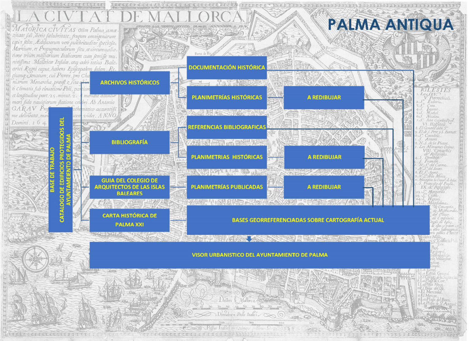
An exploration of the regional and state municipal archives will be carried out, detecting the files that contain historical planimetric and documentary information. After this, reproducibles of this documentation will be obtained and a geographic information base will be created where all this documentation will be dumped. Another phase will consist of the redrawing of all the planimetric documents before being dumped in order to allow their easy comparison. The web publication of the documentary base will be used as a basic resource for the future development of research on the historic centre of the city. Finally we will proceed to the three-dimensional survey of the obtained cartography.
Methodology
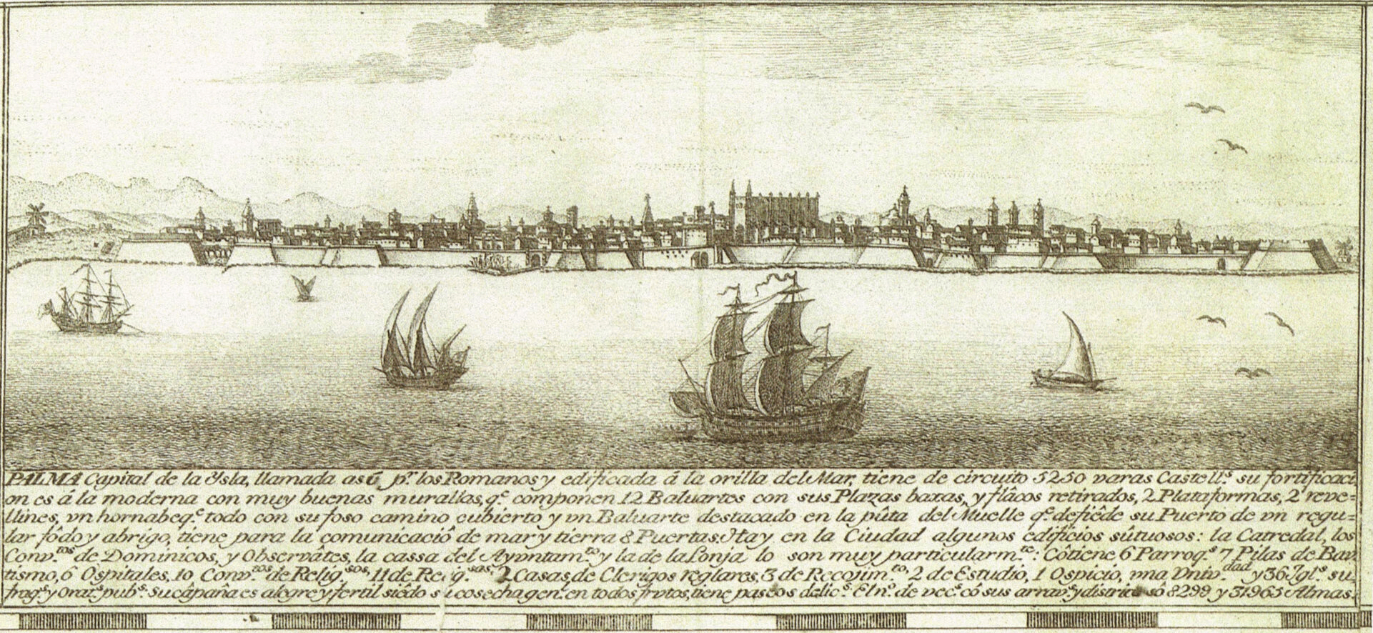
At present there is no detailed study in the city of Palma of the architecture that makes up one of the largest historical complexes in Europe.
There are several photographic works, dissemination works and works on the history and general cartography of the city, but none of them provide the support on archival and planimetric documentary sources that allow us toknow and appreciate in detail the value and evolution of the architectures that make up the historic centre. Furthermore, there is no other work of this nature in our geographical environment that allows electronic consultation of both sources of the aforementioned complexes.
The project will be articulated with the cartographic work and specialised urban viewers promoted by Palma City Council, exchanging geolocation technologies that will mutually enrich each other.
palma antiqua I
GIS map of Palma's medieval religious heritage.